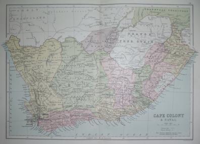
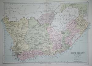
Colour printed map of Cape Colony Natal. Source: ‘Atlas of the British Empire throughout the World.’ Published 1883 by John Bartholomew and Son Ltd. Approx size 13×8.5ins. Usual fold.
This site is protected by reCAPTCHA and the Google Privacy Policy and Terms of Service apply.