

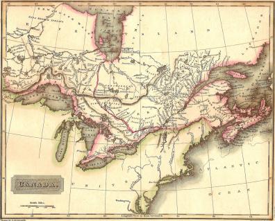
Canada from “A New General Atlas Constructed by A. Arrowsmith, Hydrographer to the King. Exhibiting the Boundaries and Divisions, also the Chains of Mountains and other Geographical Features of all the Known Countries in the World.” Engraved by Sidney Hall. Original hand-colouring. Published 1829 (dated 1817 in the plate). Approx. size of engraved area 10 x 8 inches. Full margins not captured by the scanned image.