West Indies Chart of Sea Depths & Land Elevations from Encyclopaedia Britannica 1889

West Indies Chart of Sea Depths & Land Elevations from Encyclopaedia Britannica 1889

Regular price£30.00
/
Tax included. Shipping calculated at checkout.

  • Low stock - 1 item left
  • Inventory on the way

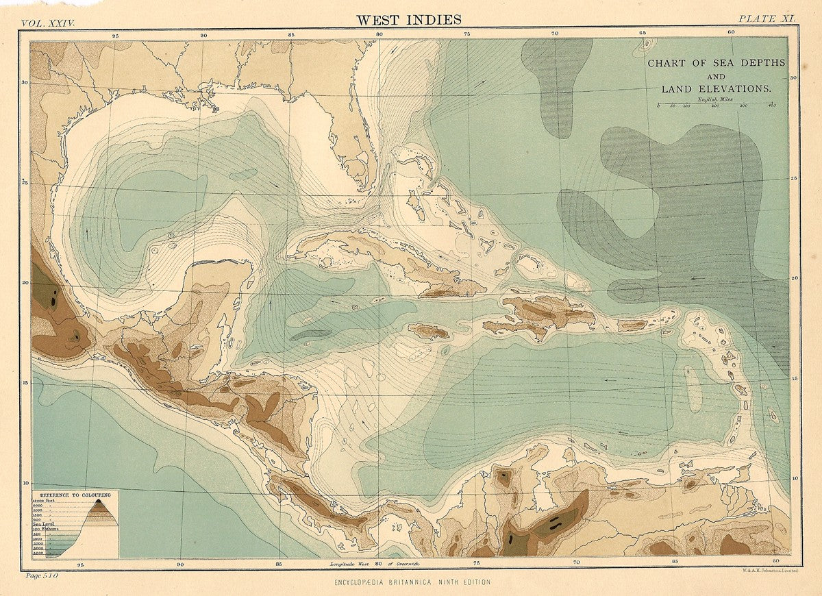
Antique map of the West Indies (Chart of Sea Depths and Land Elevations). Chromolithograph published in the Encyclopaedia Britannica Ninth Edition. Known as the “Scholars Edition”. Published 1875-1889, by W.A.K. Johnston Ltd. A&C Black Edinburgh, Scotland. Image size approx. 7×9.5 inches.


This site is protected by reCAPTCHA and the Google Privacy Policy and Terms of Service apply.