

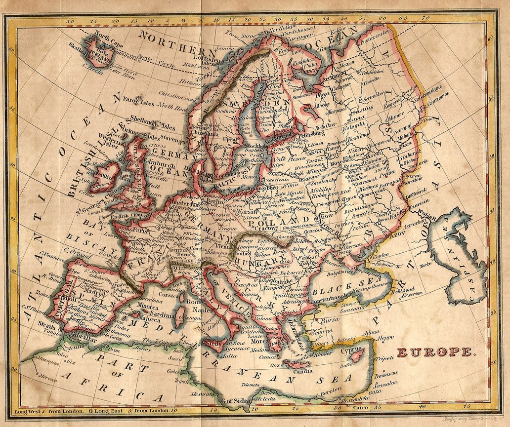
Europe antique map from “A New General Atlas Constructed by A. Arrowsmith, Hydrographer to the King. Exhibiting the Boundries and Divisions, also the Chains of Mountains and other Geographical Features of all the Known Countries in the World.” Engraved by Sidney Hall. Original hand-colouring. Published 1829 (dated 1817 in the plate). Early but not original colouring. Approx. engraved area 9x7ins. Usual folds.