Essex parliamentary boundaries antique map published 1835

Essex parliamentary boundaries antique map published 1835

Regular price£40.00
/
Tax included. Shipping calculated at checkout.

  • In stock, ready to ship
  • Inventory on the way

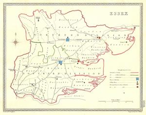
Essex parliamentary boundaries antique map published in 1835. An original outline hand-coloured antique map from Samuel Lewis’s Topographical Dictionary of England showing the hundreds and polling places. Samuel Lewis (c.1782 – 1865.) Published 1835. Image size approx. 7×9.5ins. A nice clean example.

This site is protected by reCAPTCHA and the Google Privacy Policy and Terms of Service apply.